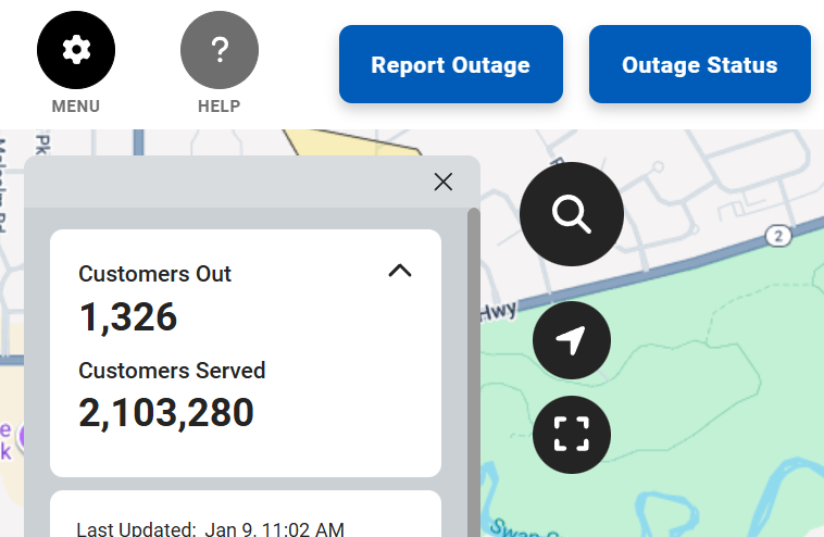
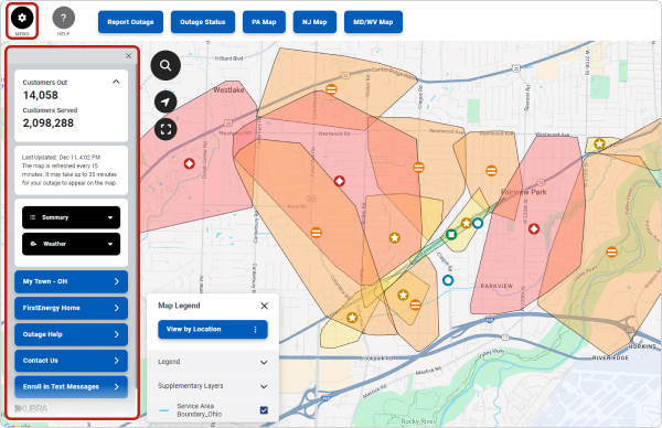
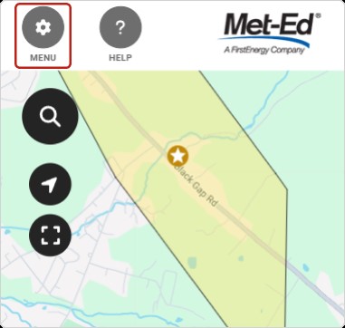
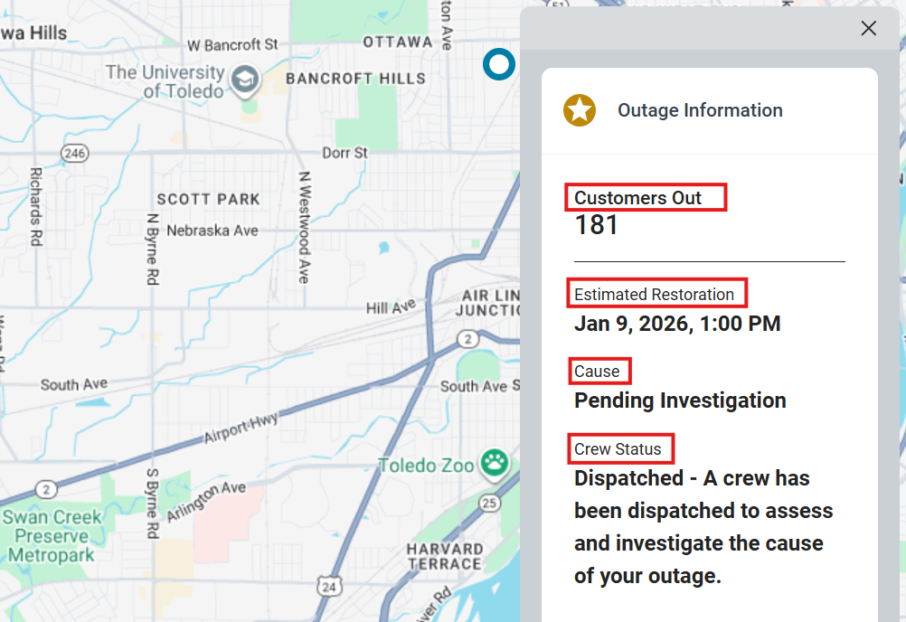
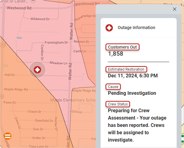
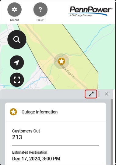
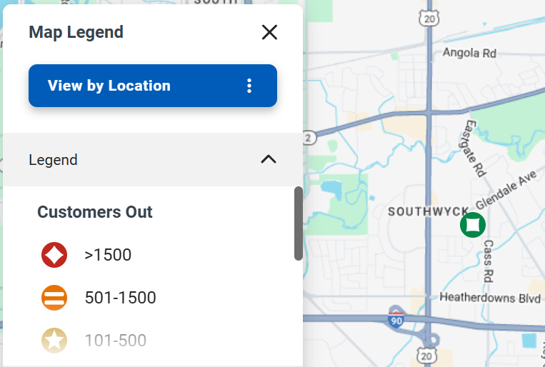
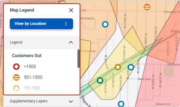
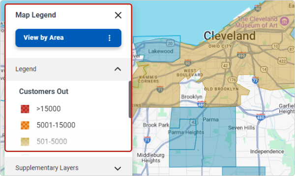
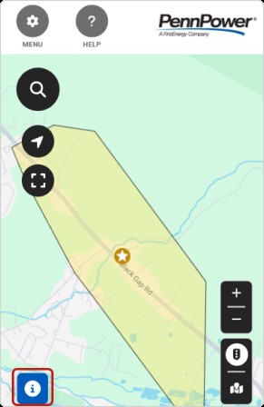
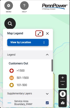
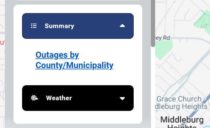
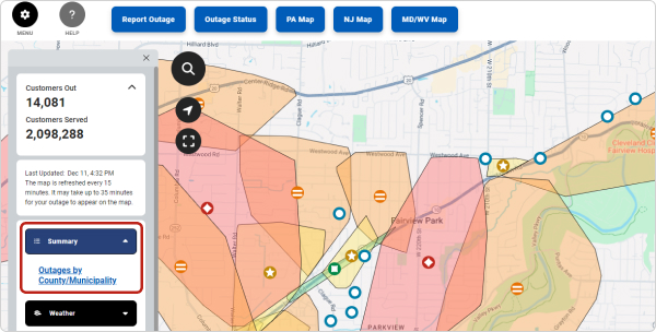
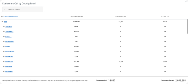
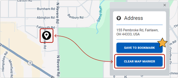
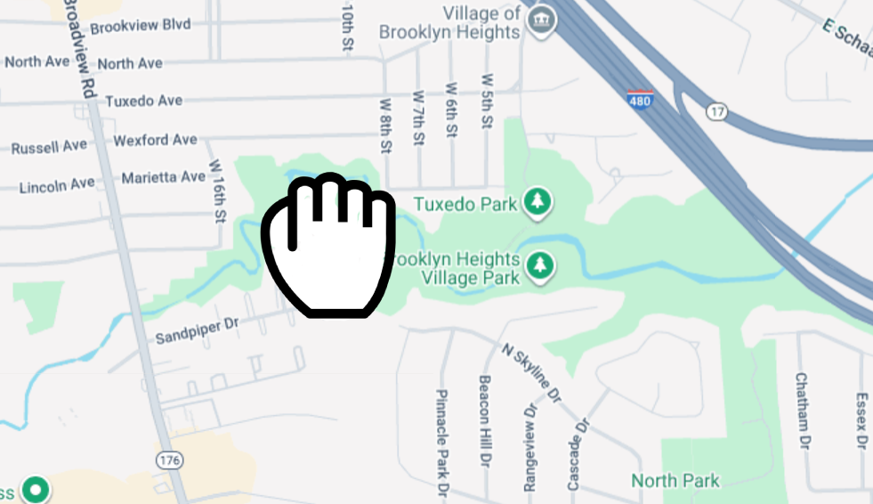
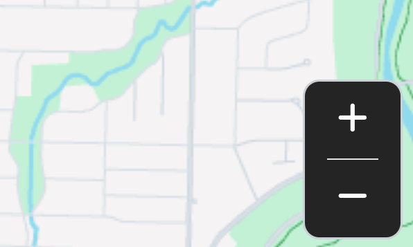
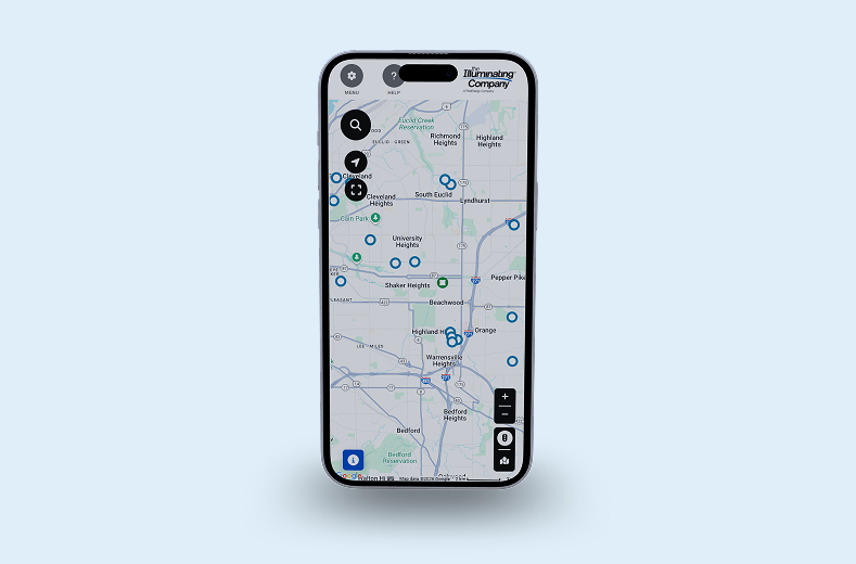
Storm Center Outage Map Help
FirstEnergy's Storm Center Outage Maps provide the best available outage information for the communities served by our utilities. Below is a summary the key features of the maps to help you navigate and find the information you need.
Please Note: Mobile devices may display some map features differently due to screen size.
Summary Outage Information
The menu opens and closes the Outage Overview Panel. The panel defaults to open on a desktop and closed on mobile devices.
To open the menu, click or tap the icon at the upper left corner of the map. The panel contains customers affected by outages, customers served by our utilities in the state, the time the outage map was last updated, a link to outage details by county (Summary) and community, weather radar capabilities (Weather). The Outage Overview Panel also includes links to the FirstEnergy website, Outage Help, the Contact Us page, and a link to Enroll in Text Messages for automated alerts.
Mobile Devices
Please Note:
This menu will default to closed on mobile devices. To open the menu, click on the Menu button in the upper left corner. Click the Menu button again to close it.

Outage Information Details
Clicking or tapping an individual outage icon, outage cluster icon or shaded region opens an info box with additional information.
The Outage Information Box includes the amount of customers impacted by the specific outage, the estimated time that we expect service to be restored, the cause of the outage (if known) and status of ours crews in the field.
.jpg)
Mobile Users
The Outage Information Box appears at the bottom of the screen on mobile-size screens. The user can select the expand icon to show more information.
%20-%20Mobile.jpg)
Map Legend
You can toggle the maps to view the approximate damage location of outages or an overview of total customers impacted by outages.
View by Location
View by Location shows color-coded icons and shaded polygons that represent the approximate outage location and number of customers affected. Outages impacting three or more locations will be represented by a polygon shape drawn around the entire area that is impacted by the outages. When multiple outages occur in close proximity, the outages are clustered into a multi-colored icon to help reduce cluttering at high zoom levels.

View by Area
View by Area shows color-coded shading that represents the number of outages in each county or municipality, based on zoom level.

Mobile Users
The Map Legend defaults as minimized to the bottom on mobile-size screens. The user can select the Information icon in the lower left to display the legend. The expand arrow icon displays more information. Select the X within the legend to minimize it.

Summary View of Outages by County or Municipality
You can view a summary of outages by county or municipality by scrolling down under the social media icons to the Summary Section. Click the “Outages by County/Municipality” link to view the information in a tabled format.

Outages by County/Municpality
This view displays each county our utilities served in the state, the number of customers affected by outages, the number of customers served and the percent of customers currently impacted by outages.
Clicking a county opens a list of municipalities currently experiencing outages. In addition to the information about the number of customers affected, this view provides estimated time of restoration for the municipality.

Please Note:
When multiple outages impact a municipality, this will present the latest Esitmated Time of Restoral (ETR) for all outages in the area. Columns are sortable by clicking on the column headers. You can quickly find an area using the “Refine by Keyword” search functionality.
Search & Bookmarks
You can search for an address to show its location on the map and create a bookmark to save the location.
To search, click the magnifying glass icon, type the address in to the search bar, select it from the list and press “Enter.”

Location Marker
A location marker will be pinned to the map location. Click on the location marker to create a bookmark and/or clear it from the screen so that the outage icon is visible.

Mobile Device Users
Due to limited screen size some of the features and options on the map may default to closed or display at the bottom of the screen. These buttons can be used to display the outage information.
Information Icon
The Information Icon can be found in the lower left-hand corner of the page. This will open the Map Legend.
Expand | Close Buttons
The button to expand or close both the Map Legend and the Outage Information Box is located in the upper right-hand corner when the Map Legend or Outage Information Box are open.
Menu Button
The Menu Button is located in the upper left-hand corner of the map and is used to open or close the Outage Overview Panel.

